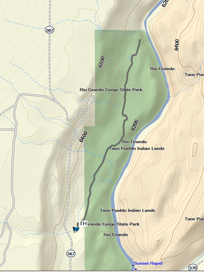
Orilla Verde – La Vista Verde Hike
In Taos Region
Map File Source: Garmin BaseCamp
 Hike Key: H10671
Last Updated: 12/15/2020 12:00am
Last Updated By: Marilyn Warrant
Hike Class: A (Easy)
Hike Distance: 2.3 mi
Minimum Elevation: 6250 ft
Elevation Change: 88 ft
Total Uphill: 165 ft
Total Downhill: 165 ft
Avg. Grade: 1 %
Route Type: InOut
On Trail: Yes
Paved or Gravel Roads: No
GPS Advised: No
Drive Distance Round Trip: 0 mi
Drive Time One-Way:
Hiking Seasons:
New Mexico Game Unit: 49
Hike Status: In Process
Highlights
Views in the Rio Grande Gorge and a chance to see bighorn sheep.
CautionsNone.
Trailhead Directions
From Albuquerque, take I-25 North to Exit 276. Follow NM-599 North for 13 miles. Use the left lane to merge onto US-285 N/US-84 W and travel 22 miles. Continue on NM-68 for 29 miles to the Rio Grande Gorge Visitor Center. From the visitor center, take NM-68 North just 410 feet, and make a left turn on NM-570. Follow scenic 570 for 6 miles, cross the bridge and follow gravel but well-maintained NM-576 less than a mile to the trailhead parking lot on the right. PARK there. Bring Golden Age Passport.
Actual Hike
After an initial short rocky descent, La Vista Verde is a walk out onto a relatively flat plateau that lies below the rim of the Rio Grande Gorge and above the river, with wonderful views. There’s a possibility of spotting bighorn sheep. The trail ends at an overlook of the river with a bench–a great spot for lunch before you turn around. A few petroglyphs can also be seen.
Comments
The track was obtained from the MTB Project website.
Map Filename: OrillaVerde-LaVistaVerdeMap_MW.jpgHike GPS File Name: LaVistaVerdeWayTrack_MW.gpx
Hike GPS File: Click link to download hike waytrack file
Text Author: Pam Bliss
Map Author: Marilyn Warrant
Waypoints Author: Marilyn Warrant
Track Author: Marilyn Warrant
Maintainer: Not Assigned
Editor: Marilyn Warrant