Michael Emery to Elena Gallegos Hike
In Albuquerque Region
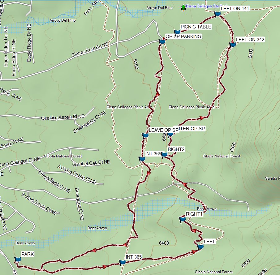
Map File Source: Garmin BaseCamp
 Hike Key: H10724
Last Updated: 12/20/2023 2:49pm
Last Updated By: Marilyn Warrant
Hike Class: B (Moderate)
Hike Distance: 5.1 mi
Minimum Elevation: 6200 ft
Elevation Change: 370 ft
Total Uphill: 660 ft
Total Downhill: 660 ft
Avg. Grade: 3 %
Route Type: CCW Loop
On Trail: Yes
Paved or Gravel Roads: Yes
GPS Advised: No
Drive Distance Round Trip: 30 mi
Drive Time One-Way: 0:30
Hiking Seasons: Spring, Summer, Fall, and Winter
New Mexico Game Unit:
Hike Status: In Process
Cautions
Watch for bicycles.
Trailhead Directions
Take Spain going east to the end and turn right onto High Desert NE. It’s a short distance to a parking area on the left.
Map Filename: MichaelEmeryToElenaGallegosMap.jpg
Hike GPS File Name: MichaelEmeryToElenaGallegosWayTrack_MW.gpx
Hike GPS File: Click link to download hike waytrack file
Text Author: Marilyn Warrant
Map Author: Marilyn Warrant
Waypoints Author: Marilyn Warrant
Track Author: Marilyn Warrant
Maintainer: Marilyn Warrant
Editor: Dawn McIntyre