Domingo Baca To Waterfall Hike
In Sandia Mountain West Region
Map File Source: NG Topo
 Hike Key: H10159
Last Updated: 03/20/2023 2:14pm
Last Updated By: Marilyn Fixer
Hike Class: C (Challenging)
Hike Distance: 5.8 mi
Minimum Elevation: 6469 ft
Elevation Change: 1239 ft
Total Uphill: 1239 ft
Total Downhill: 1239 ft
Avg. Grade: 10 %
Route Type: InOut
On Trail: Yes
Paved or Gravel Roads: Yes
GPS Advised: No
Hiker Limit (NF/BLM/NP): 15 (Sandia Wilderness)
Drive Distance Round Trip: 12 mi
Drive Time One-Way: 0:15
Hiking Seasons: Spring and Fall
New Mexico Game Unit: 8
Hike Status: Published
Highlights
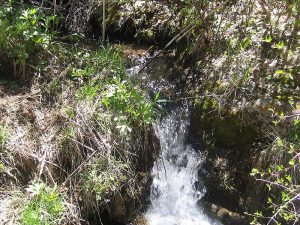
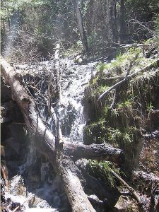
Good views of Mt. Taylor, Cabezon, and the Ladrones. A babbling brook makes for a pleasant hike. In spring, even a waterfall!
CautionsTrekking poles will be helpful for the one steep section near the top.
Trailhead Directions
Tramway north past Academy. Turn right at brown Elena Gallegos Picnic Area sign. Turn right after gate and go to parking area.
Actual Hike
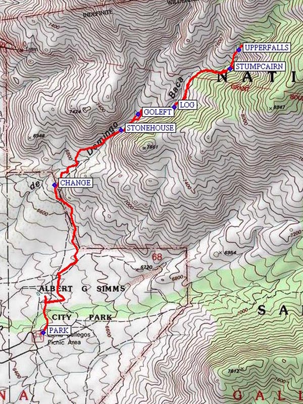
Go north to CHANGE (1.1 mi) from Elena Gallegos Park then northeast into canyon as far as desired. Watch for important turning point: where you can see Tram Tower 2 and the stream comes trickling down the right side of the canyon from about 12′ up. After the STONEHOUSE (1.7 mi), follow the water up (generally on the left of water). GOLEFT (1.8 mi) at the slick area to keep from falling, and use the convenient log to climb up at LOG (2.1 mi) . After this point, the trail gets even steeper. There’s a STUMPCAIRN (2.5 mi) marking a way to get to the lower falls (though we weren’t able to find a usable trail in 5/10). In good weather, go to UPPERFALLS (2.7 mi) which may have falling water. In any case, the tall, narrow gorge is beautiful slick rock with the first aspens of the hike and a good place for lunch.
Comments
Good views of city, distant mountains: Mt. Taylor, Cabezon, Ladron. Watch the tram cars cross in distance. Water in nice babbling brook often frozen in winter. The upper canyon is in winter shadow so can be much colder than out in the open.
WaypointsPARK: N 35 09.799, W 106 28.190
CHANGE: N 35 10.532, W 106 28.121
STONEHOUSE: N 35 10.806, W 106 27.717
GOLEFT: N 35 10.885, W 106 27.614
LOG: N 35 10.919, W 106 27.398
STUMPCAIRN: N 35 11.110, W 106 27.058
UPPERFALLS: N 35 11.205, W 106 27.002
Hike GPS File Name: DomingoBacaToWaterfallWayTrack_MWMW.gpx
Hike GPS File: Click link to download hike waytrack file
Text Author: Roger Holloway
Map Author: Marilyn Warrant
Waypoints Author: Marilyn Warrant
Track Author: Marilyn Warrant
Maintainer: Nancy Carr
Editor: Howard Carr
