Perlite Mine Ruins Hike
In Mount Taylor Region
Map File Source: NG Topo
 Hike Key: H10589
Last Updated: 12/15/2020 12:00am
Last Updated By: Marilyn Warrant
Hike Class: B (Moderate)
Hike Distance: 2.7 mi
Minimum Elevation: 7120 ft
Elevation Change: 415 ft
Total Uphill: 428 ft
Total Downhill: 428 ft
Avg. Grade: 7 %
Route Type: Messy
On Trail: No
Paved or Gravel Roads: Yes
GPS Advised: Yes
Drive Distance Round Trip: 162 mi
Drive Time One-Way: 1:30
Hiking Seasons: Spring and Fall
New Mexico Game Unit: 9
Hike Status: Published
Highlights
Many mine ruins and animal bones to explore.
CautionsUse hiking poles for steeper sections. Maximum grades are reduced if you stick to the switch back former dirt road starting in the NE area
Trailhead Directions
I-40 west to Exit 89 then take Hwy. 117 NW 5.6 miles and turn north on Sakalares Bd. for 3 miles and then east on Lobo Canyon Rd. (Hwy. 547) for about 4 miles. You will past the prison, Continental Divide trail sign on the way to the wide parking area on the left PARK.
Actual Hike
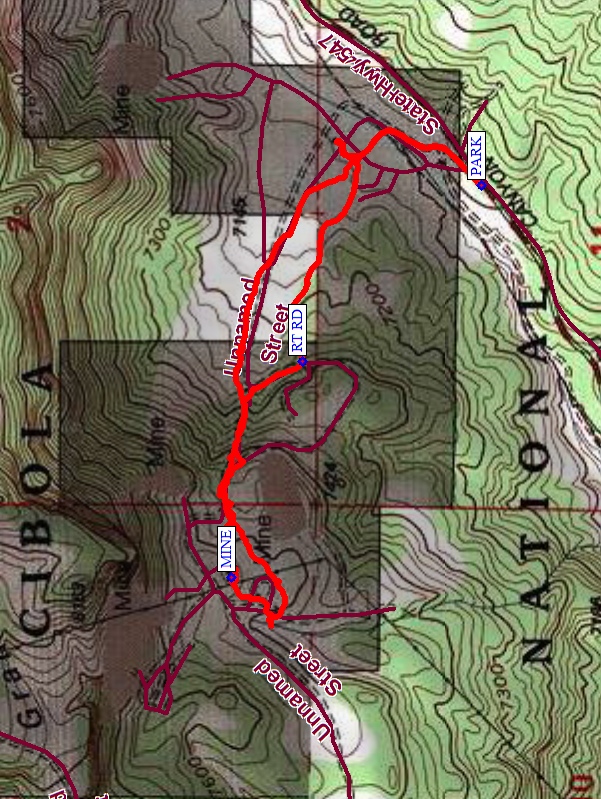
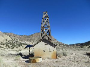
From PARK (0.0) go NE down the dirt road and go over or under the locked gate or fencing. Then go down the dirt road past the wind mill/pump house at RT RD (0.8 mi). Go northeast and catch the dirt road that goes NW and follow it uphill to MINE (1.34 mi.) Explore the extensive ruins and vehicles. If desired for more mileage, hike further up the mountain on the dirt roads to the north to see more mountain digs. There are more mine remnants here and great views of the valley. When done go back the way you came.
Comments
After the hike, plan on a great time at the Grants Mine Museum. Jack Farley who runs the museum also owns the land we hike on and gave us permission to continue hiking there.
WaypointsPARK: N35 11.947, W107 45.373
RT RD: N35 12.209, W107 45.688
MINE: N35 12.314, W107 46.073
Hike GPS File Name: PerliteMineWayTrack_FE.gpx
Hike GPS File: Click link to download hike waytrack file
Text Author: Frank Ernst
Map Author: Marilyn Warrant
Waypoints Author: Frank Ernst
Track Author: Frank Ernst
Maintainer: Frank Ernst
Editor: Howard Carr
