Ponderosa Mesa Hike
In Jemez Mountains Region
Map File Source: NG Topo
 Hike Key: H10179
Last Updated: 12/15/2020 12:00am
Last Updated By: Marilyn Warrant
Hike Class: B (Moderate)
Hike Distance: 4.2 mi
Minimum Elevation: 6960 ft
Elevation Change: 334 ft
Total Uphill: 623 ft
Total Downhill: 623 ft
Avg. Grade: 8 %
Route Type: Loop
On Trail: No
Paved or Gravel Roads: Yes
GPS Advised: Yes
Drive Distance Round Trip: 100 mi
Drive Time One-Way: 1:15
Hiking Seasons: Spring, Summer, and Fall
New Mexico Game Unit: 6A
Hike Status: Published
Highlights
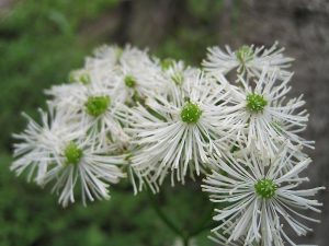
Pueblo ruins, views, and wildflowers.
CautionsCan be hot so bring extra water.
Trailhead Directions
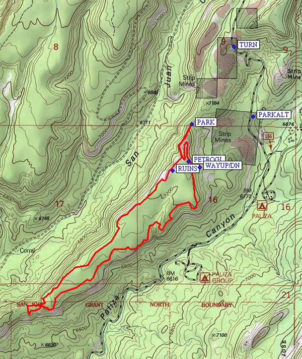
I-25 north, US 550 west, SR 4 north, SR 290 east past Ponderosa and San Juan Road. After the reservoir on the left, there is a cattleguard, and pavement changes to gravel. After first campground, road forks. Take the one to the left (Paliza). You may see a brown FS sign “10” (FR 10). You will come to an intersection of roads not much more than a minute from the last campground. Forest Rd. 266 goes off to the right. Continue up Forest Road 10 and after a couple of switchbacks you will find a primitive road off to the left at TURN. Follow road to its end and PARK (0.0 mi). If the gate on FR10 is closed before the primitive road, park at PARKALT.
Actual Hike
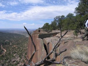
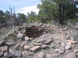
If you parked at PARKALT, head toward WAYUP/DN to get up onto the mesa. Otherwise, go up the road, keeping to the right at any trail intersections, towards the RUINS (0.3 mi). There is evidence of extensive Indian activity up there. Head around the northwestern edge of the bluff. Good viewpoint in all directions. Have lunch somewhere out on the end of the mesa. Heading back we explore the southeastern edge of the bluffs. Many interesting rock formations. Watch for the many clusters of concave scrapings. We could not figure out what caused them. The rocks seem to be hollow when stomped on (drumming sound). After rounding a big arc of bluff you will see, across the canyon, an open area with a lot of roads. That is the (now closed) Paliza Campground. Looking ahead and down the bluffs you will see the town of Ponderosa and perhaps the dam with water in it (9/30/03). Proceed to a point with a good overlook of that area. Then look at the petroglyphs (PETROGL (3.7 mi)) before returning back to your parking area.
Comments
This hike can be hot. There isn’t much shade. It’s easier to find your way if you go in the spring before the grasses have grown. There are two gates along FR10 that are locked during the winter that the Ranger Station opens between April 15 and May 15, depending on conditions.
If you try this hike in the spring, call the ranger station to make sure that GATE2 on the access map is open. Otherwise, you have a steep climb at the beginning of the hike and long walk at the end of the hike to get back to the van.
WaypointsPARKALT: N 35 42.695, W 106 37.692
TURN: N 35 43.080, W 106 37.824
WAYUP/DN: N 35 42.414, W 106 38.054
PARK: N 35 42.653, W 106 38.105
RUINS: N 35 42.398, W 106 38.236
PETROGL: N 35 42.448, W 106 38.128
Hike GPS File Name: PonderosaMesaWayTrack_JBMW.gpx
Hike GPS File: Click link to download hike waytrack file
Text Author: Roger Holloway
Map Author: Marilyn Warrant
Waypoints Author: Marilyn Warrant
Track Author: John Boyd
Maintainer: Marilyn Warrant
Editor: Howard Carr


