Valles Caldera National Preserve – Coyote Call and Beyond Hike
In Jemez Mountains Region
Map File Source: Garmin BaseCamp
 Hike Key: H10738
Last Updated: 06/13/2024 2:12pm
Last Updated By: Marilyn Warrant
Hike Class: C (Challenging)
Hike Distance: 4.8 mi
Minimum Elevation: 8724 ft
Elevation Change: 480 ft
Total Uphill: 880 ft
Total Downhill: 880 ft
Avg. Grade: 1 %
Route Type: Messy
On Trail: Yes
Paved or Gravel Roads: Yes
GPS Advised: No
Drive Distance Round Trip: 172 mi
Drive Time One-Way: 2:00
Hiking Seasons: Spring, Summer, and Fall
New Mexico Game Unit:
Hike Status: In Process
Attractions: Forest
Highlights
Views of the Valles Caldera, grassy areas with flowers, and the possibility of seeing some elk.
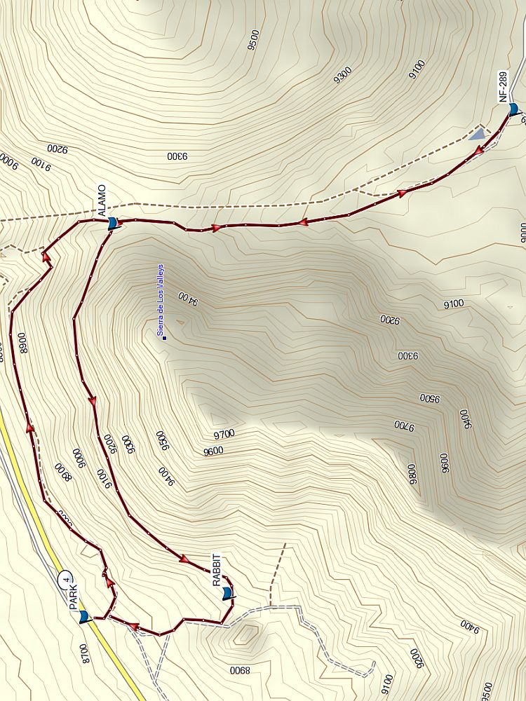
Trailhead DirectionsTake I-25 North and exit on to Hwy 550. In San Ysidro, take Hwy 4 to Jemez Pueblo and Jemez Springs. Follow Hwy 4 at fork at La Cueva (stay right). The Valles Caldera Preserve is about 22 miles from Jemez Springs. Look for the Main Gate at Mile Marker 39.2. Continue on Highway 4 past the Main Gate another 1.6 mi to a small parking area on the right by a gate and PARK (0.0 mi).
Actual HikeWe will go up Coyote Call to a meadow that joins the boundary with Bandelier at the ALAMO Boundary Trail (1.3 mi). Then we take that trail for about another mile until it reaches a gravel road NF-289 (2.3 mi). We’ll return up the ALAMO Boundary Trail, and rejoin Coyote Call, taking a left at ALAMO (3.4 mi) to RABBIT (4.4 mi) then back to PARK.
WaypointsPARK: N35 50.893 W106 27.879
ALAMO: N35 50.833, W106 26.854 (1.3)
NF-289: N35 49.996, W106 26.559 (2.3)
ALAMO: N35 50.833, W106 26.854 (3.4)
RABBIT: N35 50.594, W106 27.818 (4.4)
Hike GPS File Name: CoyoteCallAndBeyond
Hike GPS File: Click link to download hike waytrack file
Text Author: Janis Powell
Map Author: Marilyn Warrant
Waypoints Author: Marilyn Warrant
Track Author: Marilyn Warrant
Maintainer: Not Assigned
Editor: Marilyn Warrant