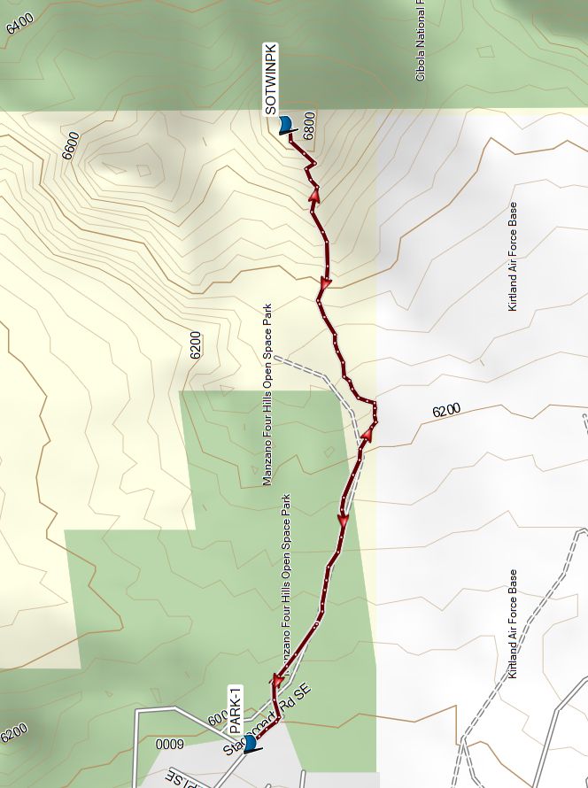
Manzano Open Space – Twin Peaks South Hike
In Albuquerque Region
Map File Source: Garmin BaseCamp
 Hike Key: H10733
Last Updated: 12/27/2023 6:34pm
Last Updated By: Marilyn Warrant
Hike Class: C (Challenging)
Hike Distance: 2.4 mi
Minimum Elevation: 5986 ft
Elevation Change: 876 ft
Total Uphill: 876 ft
Total Downhill: 876 ft
Avg. Grade: 14 %
Route Type: InOut
On Trail: Yes
Paved or Gravel Roads: Yes
GPS Advised: No
Drive Distance Round Trip: 14 mi
Drive Time One-Way: 0:30
Hiking Seasons: Spring, Fall, and Winter
New Mexico Game Unit: 14
Hike Status: In Process
Attractions: Rock Formations and Views
Highlights
TBD
CautionsTBD
Trailhead DirectionsTBD
Actual HikeTBD
CommentsThe hike difficulty is set to C because the trail is so steep overall.
This hike is based on the AllTrails hike of the same name.
WaypointsPARK: N35 02.740, W106 28.894
SOTWINPK: N35 02.688, W106 27.750
Hike GPS File Name: ManzanoOpenSpace-TwinPksS
Hike GPS File: Click link to download hike waytrack file
Text Author: Orillia Driver
Map Author:
Waypoints Author:
Track Author:
Maintainer: Not Assigned
Editor: Marilyn Warrant