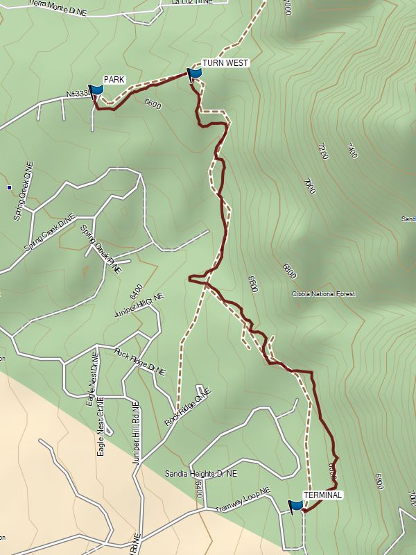
Tramway Trail South From La Cueva Hike
In Sandia Mountain West Region
Map File Source: Garmin BaseCamp
 Hike Key: H10717
Last Updated: 12/15/2022 3:32pm
Last Updated By: Marilyn Warrant
Hike Class: B (Moderate)
Hike Distance: 3.3 mi
Minimum Elevation: 6480 ft
Elevation Change: 230 ft
Total Uphill: 720 ft
Total Downhill: 720 ft
Avg. Grade: 6 %
Route Type: InOut
On Trail: Yes
Paved or Gravel Roads: Yes
GPS Advised: No
Drive Distance Round Trip: mi
Drive Time One-Way:
Hiking Seasons: Spring, Fall, and Winter
New Mexico Game Unit:
Hike Status: Place Holder
Attractions: Views
Highlights
Great views of the mountains to the east and the city to the west.
CautionsRocky trail, especially at the start and end of the hike. Very little shade.
Trailhead DirectionsTBD
Actual HikeTBD
WaypointsPARK: N35 12.295, W106 29.209
TURN WEST: N35 12.328, W106 28.977
TERMINAL: N35 11.509, W106 28.738
Hike GPS File Name: TramwayTrailSFromLaCueva.gpx
Hike GPS File: Click link to download hike waytrack file
Text Author: Sherry Blumenstock
Map Author: Marilyn Warrant
Waypoints Author: Marilyn Warrant
Track Author: Marilyn Warrant
Maintainer: Not Assigned
Editor: Marilyn Warrant