Rio Grande Nature Center To Tingley Beach Hike
In Albuquerque Region
Map File Source: DeLorme
 Hike Key: H10369
Last Updated: 12/15/2020 12:00am
Last Updated By: Marilyn Warrant
Hike Class: B (Moderate)
Hike Distance: 8.1 mi
Minimum Elevation: 4950 ft
Elevation Change: 15 ft
Total Uphill: 35 ft
Total Downhill: 35 ft
Avg. Grade: %
Route Type: Loop
On Trail: Yes
Paved or Gravel Roads: Yes
GPS Advised: No
Drive Distance Round Trip: 10 mi
Drive Time One-Way: 0:15
Hiking Seasons: Spring, Fall, and Winter
New Mexico Game Unit: 9
Hike Status: Published
Highlights
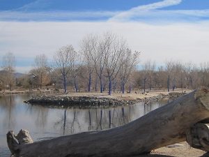
Pleasant stroll along the Rio Grande ending at Tingley Beach with ducks and colorful sculptures.
CautionsNone.
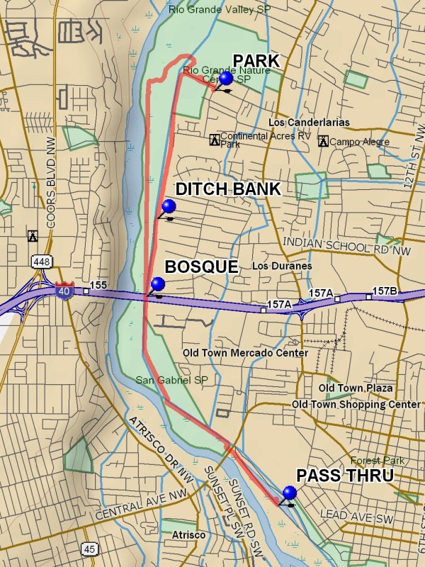
Trailhead DirectionsIn Albuquerque on the east side take Candelaria west until it dead-ends. Turn right into the Rio Grande Nature Center and PARK (0.0 mi). There is a $3 parking fee.
Actual HikeFrom parking head straight toward the river to the paved path and go south to the DITCH BANK (1.3 mi) point and take the high ditch bank to avoid competition with the hikers and rollerbladers. You will pass under I-40 and will also pass under Central at the Bio-Park. Proceed along the fence at Tingley Beach to the PASS THRU (3.8 mi) and visit the pond area for lunch. Then return to beyond the I40 underpass and bear left into the BOSQUE (5.7 mi) and find a path north along the river. Cross over the rail fence and continue until you reach the Nature Center gravel path. Take this path east to the Nature Center and back to parking.
WaypointsPARK: N 35 07.647, W 106 40.904
DITCH BANK: N 35 06.862, W 106 41.332
PASS THRU: N 35 05.103, W 106 40.424
BOSQUE: N 35 06.383, W 106 41.415
Hike GPS File Name: RioGrandeNatureCenterToTingleyBeachWayTrack_DBDB.gpx
Hike GPS File: Click link to download hike waytrack file
Text Author: Dick Brown
Map Author: Marilyn Warrant
Waypoints Author: Dick Brown
Track Author: Dick Brown
Maintainer: Not Assigned
Editor: Marilyn Warrant


